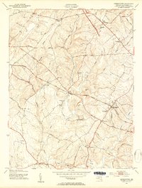
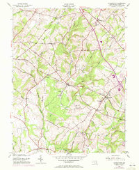
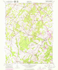
1953 Map of Germantown
USGS Topo · Published 1954About this map
Little Seneca Creek and Tenmile Creek carve through the rolling Montgomery County landscape, defining a rural era before the suburban expansion of the later 20th century. The Baltimore and Ohio Railroad serves as the primary industrial artery, anchoring settlements like Boyds and Germantown. This mid-century survey captures a distinct settlement pattern where local life centered around country schoolhouses and parish churches, such as Taylor Sch and St Marks Ch. Further south, Dawsonville and Brownstown mark the agricultural character of the region, connected by historic thoroughfares like Old Baltimore Road and Whites Ferry Road. The transition from the established community at Old Germantown toward the rail-oriented growth of the newer station area reflects the evolving transportation priorities of the 1950s.
Find a feature on this map
45 named features on this map. Tap any name to fly to it.
Don’t see what you’re looking for? This feature index may not catch every label — zoom into the map to look around manually.
Map Details
Editions of this 1953 Germantown Map
6 editions found
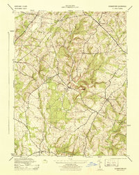
Other maps of this area

1893 · Frederick
USGS Topo · 1:125,000

1894 · Frederick
USGS Topo · 1:125,000

1908 · Rockville
USGS Topo · 1:62,500

1908 · Seneca
USGS Topo · 1:62,500

1908 · Ijamsville
USGS Topo · 1:62,500

1909 · Mount Airy
USGS Topo · 1:62,500

1909 · Ijamsville
USGS Topo · 1:62,500

1923 · Rockville
USGS Topo · 1:62,500

1942 · Frederick
USGS Topo · 1:62,500
1944 · Germantown
USGS Topo · 1:31,680