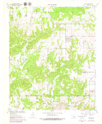
1967 Map of Gerty
USGS Topo · Published 1979About this map
The small town of Gerty serves as the focal point for this landscape in Hughes County, Oklahoma. The map documents the mid-century intersection of rural life and resource extraction, notably featuring the NE Citra Oil and Gas Field to the southwest of the main settlement. Family and community heritage is preserved through markers like Gerty Cem, Panther Creek Cem, and Salt Creek Ch, which anchor the local geography.
Find a feature on this map
18 named features on this map. Tap any name to fly to it.
Don’t see what you’re looking for? This feature index may not catch every label — zoom into the map to look around manually.
Map Details
Editions of this 1967 Gerty Map
3 editions found
Other maps of this area

1896 · Coalgate
USGS Topo · 1:125,000

1899 · Coalgate
USGS Topo · 1:125,000

1900 · Coalgate
USGS Topo · 1:125,000

1957 · Tupelo NE
USGS Topo · 1:24,000

1957 · Ardmore
USGS Topo · 1:250,000

1958 · Lula
USGS Topo · 1:24,000

1958 · Steedman
USGS Topo · 1:24,000

1963 · Ardmore
USGS Topo · 1:250,000

1967 · Calvin East
USGS Topo · 1:24,000
1967 · Non
USGS Topo · 1:24,000