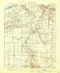
1900 Map of Girard
USGS Topo · Published 1932About this map
The industrial and agricultural corridor of northwestern Pennsylvania at the turn of the century is defined by a dense web of competing railroads. Running parallel to the Lake Erie shoreline, the Lake Shore and Michigan Southern and the New York Chicago and St. Louis railroads cut across Springfield township, while the Bessemer and Lake Erie snakes southward through the drainage basin of Conneaut Creek.
Find a feature on this map
59 named features on this map. Tap any name to fly to it.
Don’t see what you’re looking for? This feature index may not catch every label — zoom into the map to look around manually.
Map Details
Editions of this 1900 Girard Map
5 editions found
Other maps of this area

1899 · Erie
USGS Topo · 1:62,500

1900 · Girard
USGS Topo · 1:62,500

1900 · Erie
USGS Topo · 1:62,500

1900 · Fairview
USGS Topo · 1:62,500

1905 · Andover
USGS Topo · 1:48,000

1906 · Conneaut
USGS Topo · 1:62,500

1906 · Linesville
USGS Topo · 1:62,500

1907 · Andover
USGS Topo · 1:62,500

1908 · Linesville
USGS Topo · 1:62,500

1923 · Meadville
USGS Topo · 1:62,500