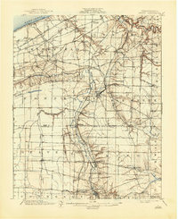
1900 Map of Girard
USGS Topo · Published 1944About this map
Lake Erie defines the northern edge of this Pennsylvania landscape, where the shoreline gives way to a dense network of late-19th-century rail infrastructure. The concentration of lines such as the Lake Shore and Michigan Southern and the Bessemer and Lake Erie underscores the region's importance as a transportation corridor between the lakefront and the interior. Moving south from the coastal bluffs, the terrain is deeply incised by Conneaut Creek and Elk Creek, which carved the valleys that dictated the placement of settlements like Albion and Springboro.
Find a feature on this map
67 named features on this map. Tap any name to fly to it.
Don’t see what you’re looking for? This feature index may not catch every label — zoom into the map to look around manually.
Map Details
Editions of this 1900 Girard Map
5 editions found
Other maps of this area

1899 · Erie
USGS Topo · 1:62,500

1900 · Girard
USGS Topo · 1:62,500

1900 · Erie
USGS Topo · 1:62,500

1900 · Fairview
USGS Topo · 1:62,500

1905 · Andover
USGS Topo · 1:48,000

1906 · Conneaut
USGS Topo · 1:62,500

1906 · Linesville
USGS Topo · 1:62,500

1907 · Andover
USGS Topo · 1:62,500

1908 · Linesville
USGS Topo · 1:62,500

1923 · Meadville
USGS Topo · 1:62,500