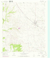
1961 Map of Godley
USGS Topo · Published 1979About this map
Godley serves as the focal point of this North Texas survey, situated at the junction of the Atchison Topeka And Santa Fe railroad and numerous drainage branches. The landscape is defined by the winding paths of West Nolan Creek and the West Fork Nolan River, which carve through the terrain of western Johnson County. The 1979 revisions, indicated in purple, reflect localized changes such as the development of a Landing Strip and shifts in woodland coverage since the original 1961 field check.
Find a feature on this map
15 named features on this map. Tap any name to fly to it.
Don’t see what you’re looking for? This feature index may not catch every label — zoom into the map to look around manually.
Map Details
Editions of this 1961 Godley Map
Other maps of this area

1889 · Granbury
USGS Topo · 1:125,000

1891 · Weatherford
USGS Topo · 1:125,000

1891 · Cleburne
USGS Topo · 1:125,000

1893 · Weatherford
USGS Topo · 1:125,000

1894 · Cleburne
USGS Topo · 1:125,000

1894 · Fort Worth
USGS Topo · 1:125,000

1923 · Granbury 1-b
USGS Topo · 1:48,000

1924 · Granbury 1-c
USGS Topo · 1:48,000

1928 · Godley
USGS Topo · 1:62,500

1954 · Dallas
USGS Topo · 1:250,000