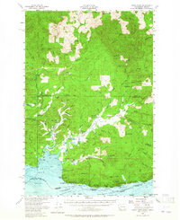
1955 Map of Grays River
USGS Topo · Published 1965About this map
Deep River and the meandering Grays River define this coastal landscape where the Columbia River meets the Pacific and Wahkiakum counties. In the mid-1950s, the area supported a network of small settlements and logging infrastructure, connected by a Railroad and several Jeep Trail routes through the timbered hills. The map details the transition from the high ridges of Elk Mountain down to the tidal flats and sloughs, including Sisson Slough and Rangila Slough. Local social and civic life is anchored by landmarks like the Community Hall near Eden and the Dahlia School. Along the southern waterfront, maritime navigation is marked by the Grays Bay Light and specific channel ranges like the Pillar Rock Lower Range, highlighting the river's importance for transport and industry during this era.
Find a feature on this map
93 named features on this map. Tap any name to fly to it.
Don’t see what you’re looking for? This feature index may not catch every label — zoom into the map to look around manually.
Map Details
Editions of this 1955 Grays River Map
3 editions found

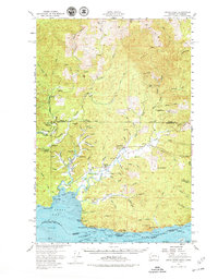
Other maps of this area

1919 · Astoria
USGS Topo · 1:62,500

1938 · Fort Columbia
USGS Topo · 1:62,500

1938 · South Bend
USGS Topo · 1:62,500

1939 · Astoria
USGS Topo · 1:62,500

1940 · Svensen
USGS Topo · 1:62,500

1940 · Brookfield
USGS Topo · 1:62,500

1940 · South Bend
USGS Topo · 1:62,500

1941 · Walville
USGS Topo · 1:62,500

1941 · Skamokawa
USGS Topo · 1:62,500

1941 · Cathlamet
USGS Topo · 1:62,500