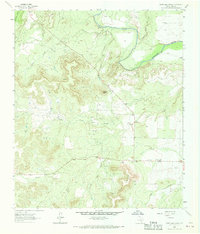
1962 Map of Green Mountain
USGS Topo · Published 1968About this map
The Colorado River carves a sharp path across the northern reaches of this West Texas landscape, where the rugged terrain transitions from the high elevations of Green Mountain and Shaggy Peak into deep-cut drainage systems. In the early 1960s, this section of Coke County was defined by its dual identity as ranching country and an active petroleum frontier. The Millican Oil Field and Lygay Oil Field are prominent across the central and northern sections, marked by numerous drill holes and oil wells that dot the hillsides. Local community life is anchored at the Green Mountain Community Center and the Pecan Ch near the banks of North Pecan Creek. Genealogical interest is found in isolated sites like the Terry Cem, while the industrial footprint of the era is evident in the scattered gravel pits and extensive fence lines that partition the arid draws and mesas.
Find a feature on this map
20 named features on this map. Tap any name to fly to it.
Don’t see what you’re looking for? This feature index may not catch every label — zoom into the map to look around manually.
Map Details
Editions of this 1962 Green Mountain Map
3 editions found
Other maps of this area

1954 · Big Spring
USGS Topo · 1:250,000

1954 · San Angelo
USGS Topo · 1:250,000

1958 · San Angelo
USGS Topo · 1:250,000

1958 · Big Spring
USGS Topo · 1:250,000

1959 · Silver
USGS Topo · 1:24,000

1959 · Dead Indian Mountain
USGS Topo · 1:24,000

1962 · Edith
USGS Topo · 1:24,000

1962 · Sanco
USGS Topo · 1:24,000
1962 · Millican Mountains
USGS Topo · 1:24,000

1962 · Green Mountain
USGS Topo · 1:24,000