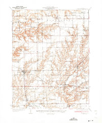
1932 Map of Greenfield
USGS Topo · Published 1932About this map
Greenfield serves as a central hub on this 1932 survey, situated at the junction of the Chicago Burlington and Quincy and the Chicago and Alton railroads. The landscape is defined by the sharp transition between flat agricultural uplands and the deeply etched drainages of Apple Creek and Macoupin Creek. Small agricultural hamlets such as Fayette, Hettick, and Rockbridge are linked by the State Highway No 108 and the now-vanished Chicago Springfield and St Louis line.
Find a feature on this map
92 named features on this map. Tap any name to fly to it.
Don’t see what you’re looking for? This feature index may not catch every label — zoom into the map to look around manually.
Map Details
Editions of this 1932 Greenfield Map
3 editions found

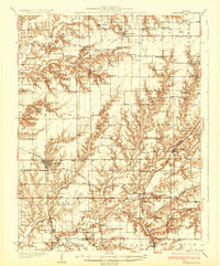
Other maps of this area

1912 · Gillespie
USGS Topo · 1:62,500

1915 · Gillespie
USGS Topo · 1:62,500

1923 · Carlinville
USGS Topo · 1:48,000

1924 · Winchester
USGS Topo · 1:48,000

1924 · Waverly
USGS Topo · 1:62,500

1924 · Roodhouse
USGS Topo · 1:62,500

1925 · Carlinville
USGS Topo · 1:62,500

1925 · Brighton
USGS Topo · 1:62,500

1926 · Winchester
USGS Topo · 1:62,500

1926 · Waverly
USGS Topo · 1:62,500