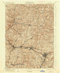
1906 Map of Greensburg
USGS Topo · Published 1937About this map
Industrial and agricultural development defines Westmoreland County during the early 1900s, centered around the robust presence of the Pennsylvania RR. The corridor between Irwin and Jeannette is densely packed with settlements like Westmoreland City, North Irwin, and Penn Sta, illustrating the growth of residential and industrial pockets along the main rail lines. To the north, the terrain transitions into a more rural landscape dotted with small hamlets such as Newlonsburg and Export, where natural resources like Turtle Creek and Brush Creek dictate the layout of the roads and early settlements.
Find a feature on this map
85 named features on this map. Tap any name to fly to it.
Don’t see what you’re looking for? This feature index may not catch every label — zoom into the map to look around manually.
Map Details
Editions of this 1906 Greensburg Map
6 editions found


Other maps of this area

1900 · Latrobe
USGS Topo · 1:62,500

1902 · Latrobe
USGS Topo · 1:62,500

1902 · Brownsville
USGS Topo · 1:62,500

1902 · Connellsville
USGS Topo · 1:62,500

1902 · Elders Ridge
USGS Topo · 1:62,500

1903 · Latrobe
USGS Topo · 1:62,500

1904 · Elders Ridge
USGS Topo · 1:62,500

1904 · Mc Keesport
USGS Topo · 1:62,500

1904 · Greensburg
USGS Topo · 1:62,500

1906 · Brownsville
USGS Topo · 1:62,500