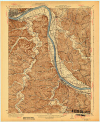
1930 Map of Greenup
USGS Topo · Published 1940About this map
The Ohio River valley serves as a critical industrial and transport artery at this bend between Kentucky and Ohio, where the Chesapeake and Ohio and Norfolk and Western railroads line the banks. The landscape is defined by the transition from the bustling riverfronts of Fullerton and South Portsmouth to the deeply dissected ridges of the interior. A legacy of early regional industry is evident in the presence of Franklin Furnace, Junior Furnace, and Ohio Furnace on the Ohio side, alongside the Twin Oaks Mill. Educational life in the rural hollows is remarkably well-documented, with dozens of local institutions such as Forest Academy School, Beauty Ridge School, and Valley View School serving isolated communities. Unique river infrastructure, including Dam No 30 and the curiously named Wizard Oil Bridge, highlights the engineered character of the early 20th-century waterway.
Find a feature on this map
131 named features on this map. Tap any name to fly to it.
Don’t see what you’re looking for? This feature index may not catch every label — zoom into the map to look around manually.
Map Details
Editions of this 1930 Greenup Map
3 editions found

Other maps of this area

1898 · Ironton
USGS Topo · 1:62,500

1900 · Ironton
USGS Topo · 1:62,500

1901 · Ceredo
USGS Topo · 1:62,500

1903 · Kenova
USGS Topo · 1:125,000

1904 · Kenova
USGS Topo · 1:125,000

1911 · Sciotoville
USGS Topo · 1:62,500

1912 · Oak Hill
USGS Topo · 1:62,500

1913 · Ceredo
USGS Topo · 1:62,500

1913 · Sciotoville
USGS Topo · 1:62,500

1915 · Garrison
USGS Topo · 1:62,500