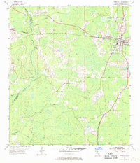
1954 Map of Greenville
USGS Topo · Published 1968About this map
Greenville serves as a local hub in the mid-1950s, situated at the junction of the Seaboard Air Line and Southern railroads. This network of rails and the central Base Line road define the transport geography of western Madison County. The landscape is heavily marked by the drainage of the Aucilla River and its tributaries, including the Little Aucilla River and Wolf Creek. Numerous rural landmarks suggest a deeply rooted community, from the Aucilla Lookout Tower used for forest monitoring to several country congregations such as St Mathews Ch and New Zion Ch. A concentration of family and community burial grounds, including Hensey Cem and Barclay Cem, provides valuable location data for genealogists tracing ancestors in the Aucilla and Raysor vicinities.
Find a feature on this map
25 named features on this map. Tap any name to fly to it.
Don’t see what you’re looking for? This feature index may not catch every label — zoom into the map to look around manually.
Map Details
Editions of this 1954 Greenville Map
Other maps of this area

1954 · Greenville
USGS Topo · 1:24,000

1954 · Greenville NE
USGS Topo · 1:24,000

1954 · Valdosta
USGS Topo · 1:250,000

1955 · Lamont
USGS Topo · 1:24,000

1955 · Shady Grove
USGS Topo · 1:24,000

1955 · Lamont SE
USGS Topo · 1:24,000

1955 · Greenville SE
USGS Topo · 1:24,000

1958 · Valdosta
USGS Topo · 1:250,000

1959 · Valdosta
USGS Topo · 1:250,000

1962 · Ashville
USGS Topo · 1:24,000