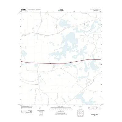
2012 Map of Greenville NE
USGS Topo · Published 2012About this map
Sampala Lake and the marshy expanses of the Suwannee River watershed dominate the landscape of northeast Madison County in the early 21st century. This region of North Florida is defined by its transition between agricultural ranching and protected wetlands, notably visible near the Pratt Ranch Airport. The topography is relatively flat, shaped by slow-moving water bodies like Indian Lake and the meandering Sundown Cr. Local history is anchored by rural landmarks such as Evergreen Cem in the northwest and Oakland Cem in the southeast. A network of county roads, including Elizabeth H Sims Rd and Captain Brown Rd, provides access to the scattered homesteads and timberlands that characterize the area's rural economy. The presence of these named family roads and cemeteries offers valuable points of reference for those tracing local lineages or the evolution of north-central Florida land use.
Find a feature on this map
21 named features on this map. Tap any name to fly to it.
Don’t see what you’re looking for? This feature index may not catch every label — zoom into the map to look around manually.
Map Details
Editions of this 2012 Greenville NE Map
This is the sole edition of this map. No revisions or reprints were ever made.
Other maps of this area

1954 · Greenville
USGS Topo · 1:24,000

1954 · Greenville NE
USGS Topo · 1:24,000

1954 · Valdosta
USGS Topo · 1:250,000

1955 · Shady Grove
USGS Topo · 1:24,000

1955 · Greenville SE
USGS Topo · 1:24,000

1958 · Valdosta
USGS Topo · 1:250,000

1958 · Madison SW
USGS Topo · 1:24,000

1959 · Valdosta
USGS Topo · 1:250,000

1959 · Madison
USGS Topo · 1:24,000

1960 · Cherry Lake
USGS Topo · 1:24,000