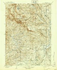
1910 Map of Gros Ventre
USGS Topo · Published 1939About this map
Gros Ventre River and Green River headwaters define this 1907 survey of western Wyoming, a landscape characterized by isolated homesteads and high-altitude basins. The map documents the early ranching footprint of the region, featuring numerous family-named sites such as Lloyds Ranch, Darwin's Ranch, and Reasor's Ranch. These settlements are scattered along creek drainages like Fish Creek and Beaver Creek, often miles apart.
Find a feature on this map
102 named features on this map. Tap any name to fly to it.
Don’t see what you’re looking for? This feature index may not catch every label — zoom into the map to look around manually.
Map Details
Editions of this 1910 Gros Ventre Map
3 editions found
Other maps of this area

1899 · Grand Teton
USGS Topo · 1:125,000

1901 · Grand Teton
USGS Topo · 1:125,000

1902 · Mt Leidy
USGS Topo · 1:125,000

1905 · Younts Peak
USGS Topo · 1:125,000

1907 · Younts Peak
USGS Topo · 1:125,000

1907 · Gros Ventre
USGS Topo · 1:125,000

1909 · Fremont Peak
USGS Topo · 1:125,000

1910 · Gros Ventre
USGS Topo · 1:125,000

1921 · Afton
USGS Topo · 1:125,000

1931 · Jackson
USGS Topo · 1:125,000