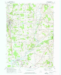
1970 Map of Groton
USGS Topo · Published 1974About this map
Groton stands as a primary hub in this Finger Lakes region landscape, where the Lehigh Valley railroad corridor follows the valley of the Owasco Inlet. The map illustrates a dense network of nineteenth-century rural crossroads, identifying specific local landmarks such as Morton Corners, Lafayette Corners, and Merchants Corners. This 1970 field-checked survey highlights the educational and social infrastructure of the time, including the George Junior Republic High Sch and Dryden High Sch.
Find a feature on this map
76 named features on this map. Tap any name to fly to it.
Don’t see what you’re looking for? This feature index may not catch every label — zoom into the map to look around manually.
Map Details
Editions of this 1970 Groton Map
2 editions found
Other maps of this area

1898 · Moravia
USGS Topo · 1:62,500

1900 · Dryden
USGS Topo · 1:62,500

1902 · Moravia
USGS Topo · 1:62,500

1903 · Cortland
USGS Topo · 1:62,500

1903 · Harford
USGS Topo · 1:62,500

1906 · Catatonk
USGS Topo · 1:125,000

1942 · Groton
USGS Topo · 1:24,000

1943 · Moravia
USGS Topo · 1:31,680

1943 · West Groton
USGS Topo · 1:31,680

1943 · Groton
USGS Topo · 1:31,680