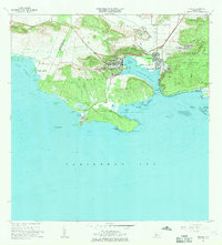
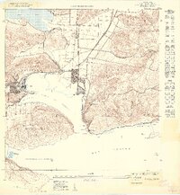
1966 Map of Guanica
USGS Topo · Published 1969About this map
Central Guánica stands as a focal point of industrial activity on this southern coast, marking the site of one of the island's major sugar mills. The map illustrates a landscape of intense utility and preservation, where the concentrated settlement at Ensenada and the town of Guánica give way to the sprawling Bosque Estatal de Guánica. This coastal forest area is etched with topographical detail from Monte de la Brea to Cerro Caprón, protecting a rugged shoreline defined by the Bahía de Guánica and Ensenada Las Pardas. Educational and civic life is anchored by locations like Escuela José Gautier Benítez and the Cementerio Municipal. The presence of the Faro de Guánica and the Balneario de Caña Gorda highlights the area's dual identity as both a working maritime hub and a site for coastal recreation.
Find a feature on this map
77 named features on this map. Tap any name to fly to it.
Don’t see what you’re looking for? This feature index may not catch every label — zoom into the map to look around manually.
Map Details
Editions of this 1966 Guanica Map
3 editions found
Other maps of this area

1937 · San German
USGS Topo · 1:25,000

1937 · Sabana Grande
USGS Topo · 1:25,000

1938 · Guanica
USGS Topo · 1:30,000

1938 · Parguera
USGS Topo · 1:30,000

1941 · San German
USGS Topo · 1:30,000

1941 · Sabana Grande
USGS Topo · 1:30,000

1946 · Yauco
USGS Topo · 1:30,000

1946 · Punta Verraco
USGS Topo · 1:30,000
1947 · Yauco SO
USGS Topo · 1:10,000
1949 · Guanica NE
USGS Topo · 1:10,000