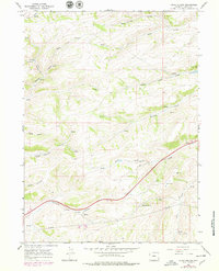
1965 Map of Guild Hollow
USGS Topo · Published 1979About this map
Guild Hollow and the surrounding drainage basins of Byrne Creek define this Uinta County landscape during the late 1960s and 1970s. The terrain is deeply incised by family-named features such as Duncomb Hollow, Robinson Hollow, and Hinshaw Hollow, reflecting a history of local land use and seasonal water management. This period shows a notable transition in infrastructure, with the expansion of a 4 Lane highway cutting through the heart of the hollows and the presence of significant utility corridors marked by Pipelines.
Find a feature on this map
30 named features on this map. Tap any name to fly to it.
Don’t see what you’re looking for? This feature index may not catch every label — zoom into the map to look around manually.
Map Details
Editions of this 1965 Guild Hollow Map
3 editions found
Other maps of this area

1954 · Ogden
USGS Topo · 1:250,000

1958 · Ogden
USGS Topo · 1:250,000

1960 · Ogden
USGS Topo · 1:250,000

1965 · Evanston
USGS Topo · 1:24,000

1965 · Ragan
USGS Topo · 1:24,000

1965 · Little Dee Creek
USGS Topo · 1:24,000

1965 · Meadow Draw
USGS Topo · 1:24,000

1965 · Sulphur Creek Reservoir
USGS Topo · 1:24,000

1965 · Guild Hollow
USGS Topo · 1:24,000

1965 · Three Forks
USGS Topo · 1:24,000