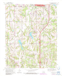
1970 Map of Guthrie South
USGS Topo · Published 1983About this map
Guthrie's southern outskirts and the surrounding Logan County countryside are defined by a mix of early industrial infrastructure and suburban expansion. The Atchison Topeka and Santa Fe railroad corridor cuts through the landscape, flanked by the Iron Mound terrain to the west and the developing Southwest Gas and Oil Field to the south. These resource-driven foundations contrast with mid-century recreational and civic additions like Guthrie Lake, Liberty Lake, and the Drive-in Theater. Further south, the settlement of Seward remains a focal point for genealogical research, anchored by the Seward Cem and Memorial Cem. The inclusion of the Job Corps Center and Guthrie Municipal Airport illustrates the area's transition from a rural railroad stop into a modernized regional hub, all while maintaining historic landmarks like Mt Pleasant Ch and the Faust Sch.
Find a feature on this map
37 named features on this map. Tap any name to fly to it.
Don’t see what you’re looking for? This feature index may not catch every label — zoom into the map to look around manually.
Map Details
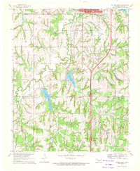
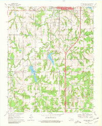
Editions of this 1970 Guthrie South Map
3 editions found
Other maps of this area

1892 · Guthrie
USGS Topo · 1:62,500

1892 · Edmond
USGS Topo · 1:62,500

1892 · Kingfisher
USGS Topo · 1:125,000

1895 · Kingfisher
USGS Topo · 1:125,000

1935 · Edmond
USGS Topo · 1:48,000

1940 · Edmond
USGS Topo · 1:62,500

1954 · Oklahoma City
USGS Topo · 1:250,000

1957 · Oklahoma City
USGS Topo · 1:250,000

1963 · Oklahoma City
USGS Topo · 1:250,000
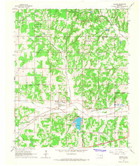
1966 · Arcadia
USGS Topo · 1:24,000