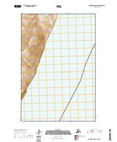
2018 Map of Hagemeister Island C-3 NE
USGS Topo · Published 2018About this map
Pacific Ocean waters dominate the eastern half of this coastal Alaskan landscape, meeting a shoreline defined by significant elevation changes. This particular stretch of the Bristol Bay region is mapped through the Public Land Survey System, showing the transition from the maritime environment into the upland terrain of t17s r70w and t16s r69w. The survey highlights the sharp contrast between the sea and the coastal slopes, providing a clear record of the shoreline and the sectional boundaries that organize this remote stretch of the Dillingham Census Area.
Find a feature on this map
5 named features on this map. Tap any name to fly to it.
Don’t see what you’re looking for? This feature index may not catch every label — zoom into the map to look around manually.
Map Details
Editions of this 2018 Hagemeister Island C-3 NE Map
This is the sole edition of this map. No revisions or reprints were ever made.
Other maps of this area

1947 · Hagemeister Island D-2
USGS Topo · 1:63,360

1948 · Hagemeister Island D-3
USGS Topo · 1:63,360

1948 · Hagemeister Island C-3
USGS Topo · 1:63,360
1948 · Hagemeister Island C-2
USGS Topo · 1:63,360

1951 · Hagemeister Island
USGS Topo · 1:250,000

1952 · Hagemeister Island C-3
USGS Topo · 1:63,360

1952 · Hagemeister Island C-2
USGS Topo · 1:63,360

1953 · Hagemeister Island D-2
USGS Topo · 1:63,360

1957 · Hagemeister Island
USGS Topo · 1:250,000
2018 · Hagemeister Island D-3 SE
USGS Topo · 1:25,000