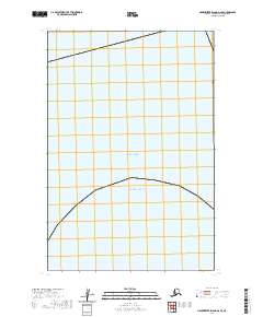
2020 Map of Hagemeister Island D-2 SE
USGS Topo · Published 2020About this map
Bristol Bay and the Pacific Ocean meet in this remote coastal reach of the Dillingham Census Area. This maritime survey illustrates the meeting point of these two massive bodies of water, primarily defined by the open sea rather than land-based landmarks. The map is dominated by the Public Land Survey System grid, specifically within t15s r66w, t16s r67w, and t16s r66w, providing a precise geometric framework for this undeveloped expanse of the Alaskan coastline. Without established settlements, schools, or roads, the map captures the raw intersection of the Bering Sea and the North Pacific, reflecting a landscape where the tide and the survey line are the primary defining features.
Find a feature on this map
5 named features on this map. Tap any name to fly to it.
Don’t see what you’re looking for? This feature index may not catch every label — zoom into the map to look around manually.
Map Details
Editions of this 2020 Hagemeister Island D-2 SE Map
This is the sole edition of this map. No revisions or reprints were ever made.
Other maps of this area

1947 · Hagemeister Island D-2
USGS Topo · 1:63,360
1948 · Hagemeister Island C-2
USGS Topo · 1:63,360

1948 · Hagemeister Island C-1
USGS Topo · 1:63,360

1950 · Hagemeister Island D-1
USGS Topo · 1:63,360

1951 · Hagemeister Island
USGS Topo · 1:250,000

1952 · Hagemeister Island C-1
USGS Topo · 1:63,360

1952 · Hagemeister Island C-2
USGS Topo · 1:63,360

1952 · Hagemeister Island D-1
USGS Topo · 1:63,360

1953 · Hagemeister Island D-2
USGS Topo · 1:63,360

1957 · Hagemeister Island
USGS Topo · 1:250,000