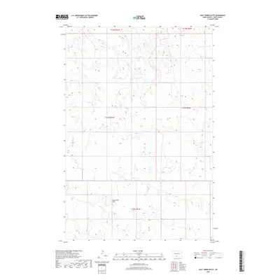
2018 Map of Half Timber Butte
USGS Topo · Published 2018About this map
Half Timber Butte serves as the central geographic landmark in this sparsely populated stretch of the Cannonball District within Sioux County. The landscape is primarily defined by its drainage patterns, most notably the winding course of Battle Cr which meanders through the southern and western portions of the quadrangle. Beyond the occasional section line road such as 16th Ave, the map reveals a terrain mostly devoid of dense settlement, highlighting the open grazing or agricultural land characteristic of this region in the late twenty-first century. This survey by the U.S. Geological Survey provides a precise view of the topography before any further modern development, focusing on the natural contours and watercourses like Battle Cr that have dictated land use in this part of North Dakota for generations.
Find a feature on this map
8 named features on this map. Tap any name to fly to it.
Don’t see what you’re looking for? This feature index may not catch every label — zoom into the map to look around manually.
Map Details
Editions of this 2018 Half Timber Butte Map
This is the sole edition of this map. No revisions or reprints were ever made.
Other maps of this area

1954 · Bismarck
USGS Topo · 1:250,000

1958 · Bismarck
USGS Topo · 1:250,000

1968 · Fort Yates NW
USGS Topo · 1:24,000

1968 · Cannon Ball NW
USGS Topo · 1:24,000

1968 · Cannon Ball SW
USGS Topo · 1:24,000

1971 · Barren Butte
USGS Topo · 1:24,000

1971 · Half Timber Butte
USGS Topo · 1:24,000

1971 · Froelich Dam
USGS Topo · 1:24,000

1971 · Solen SW
USGS Topo · 1:24,000

1980 · Solen
USGS Topo · 1:24,000