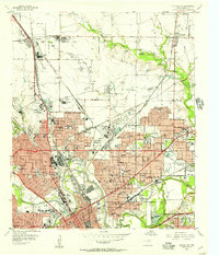
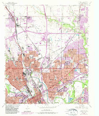
1955 Map of Haltom City
USGS Topo · Published 1957About this map
Fort Worth and Haltom City expand across this mid-1950s survey, illustrating a period of rapid industrial and suburban development along the West Fork Trinity River. The landscape is dominated by heavy infrastructure, from the sprawling Meacham Field Municipal Airport and numerous refineries to the intricate rail network of the Chicago Rock Island and Pacific and Fort Worth and Denver railroads. Local history and genealogy are preserved in the numerous cemeteries like Mount Olivet Cemetery and Pioneers Rest Cem, while emerging residential tracts such as Saginaw Park and Melody Hills show the city's outward reach. Notable landmarks include the Aircraft Plant near Saginaw and the Radio Television Station (WBAP), highlighting the era's economic drivers in aerospace and media.
Find a feature on this map
84 named features on this map. Tap any name to fly to it.
Don’t see what you’re looking for? This feature index may not catch every label — zoom into the map to look around manually.
Map Details
Editions of this 1955 Haltom City Map
6 editions found
Other maps of this area

1894 · Fort Worth
USGS Topo · 1:125,000

1931 · Grapevine
USGS Topo · 1:62,500

1954 · Dallas
USGS Topo · 1:250,000

1955 · Haltom City
USGS Topo · 1:24,000

1955 · Avondale
USGS Topo · 1:24,000

1955 · Keller
USGS Topo · 1:24,000

1955 · Lake Worth
USGS Topo · 1:24,000

1955 · Benbrook
USGS Topo · 1:24,000

1955 · Fort Worth
USGS Topo · 1:24,000

1955 · Haltom City
USGS Topo · 1:62,500