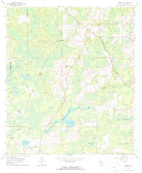
1962 Map of Hamburg
USGS Topo · Published 1964About this map
The Aucilla River and Little Aucilla River converge in this corner of Madison County, carving a landscape defined by expansive wetlands and isolated hammocks. Small settlements like Hamburg and Maysland anchor the rural landscape, connected by the distinct Southern Railroad Grade that cuts across the western portion of the quadrangle. For those tracing family histories in this part of Florida, the map identifies several local landmarks of worship and education, including the Ebenezer Ch and the Hamburg Sch. The terrain is marked by numerous water bodies and sinkholes, such as Blue Sink and Johannah Lake, along with the curiously named Devils Woodyard in the southeast. Scattered family-named sites like the Redding Hammock Cem and Reaper Cem provide specific points of interest for genealogists and local historians documenting the early 1960s community structure.
Find a feature on this map
34 named features on this map. Tap any name to fly to it.
Don’t see what you’re looking for? This feature index may not catch every label — zoom into the map to look around manually.
Map Details
Editions of this 1962 Hamburg Map
3 editions found
Other maps of this area

1954 · Greenville
USGS Topo · 1:24,000

1954 · Greenville NE
USGS Topo · 1:24,000

1954 · Valdosta
USGS Topo · 1:250,000

1956 · Grooverville
USGS Topo · 1:24,000

1956 · Nankin
USGS Topo · 1:24,000

1956 · Baden
USGS Topo · 1:24,000

1958 · Valdosta
USGS Topo · 1:250,000

1959 · Valdosta
USGS Topo · 1:250,000

1959 · Madison
USGS Topo · 1:24,000

1960 · Cherry Lake
USGS Topo · 1:24,000