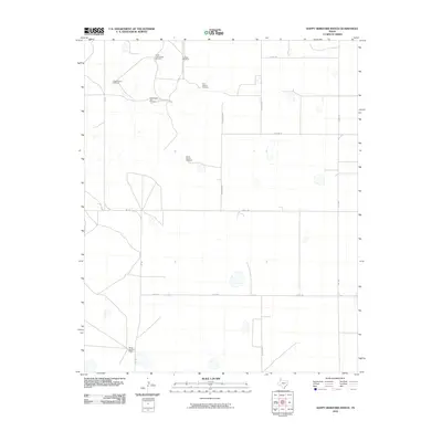
2010 Map of Happy Hereford Ranch
USGS Topo · Published 2010About this map
Happy Hereford Ranch anchors this high plains landscape in Randall County, illustrating the essential relationship between cattle ranching and water access. The map reveals a network of vital water sources designated for specific ranching operations, such as North Cottonwood Windmill and Cottonwood Trap Windmill. These landmarks, along with South Pasture Windmill and East Pasture Windmill, define the functional geography of the Panhandle ranching tradition. The presence of the Schoolhouse Windmill suggests the location of earlier rural community hubs. A rectilinear grid of roads, including FM 168, Bushland Rd, and Haley Rd, cuts through the terrain, connecting these remote outposts to the wider region.
Find a feature on this map
16 named features on this map. Tap any name to fly to it.
Don’t see what you’re looking for? This feature index may not catch every label — zoom into the map to look around manually.
Map Details
Editions of this 2010 Happy Hereford Ranch Map
This is the sole edition of this map. No revisions or reprints were ever made.
Other maps of this area

1954 · Plainview
USGS Topo · 1:250,000

1954 · Clovis
USGS Topo · 1:250,000

1958 · Clovis
USGS Topo · 1:250,000

1958 · Plainview
USGS Topo · 1:250,000

1960 · Canyon
USGS Topo · 1:62,500

1961 · Buffalo Lake
USGS Topo · 1:62,500

1966 · Tulia NW
USGS Topo · 1:24,000

1966 · Nazareth NW
USGS Topo · 1:24,000

1966 · Arney
USGS Topo · 1:24,000
1984 · Canyon
USGS Topo · 1:24,000