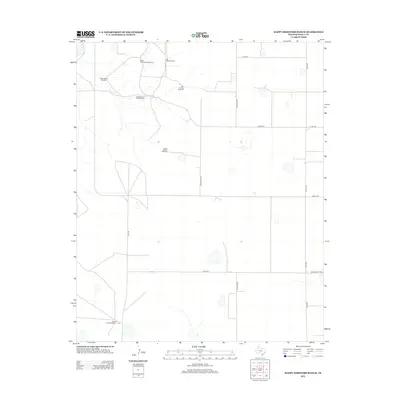
2012 Map of Happy Hereford Ranch
USGS Topo · Published 2012About this map
Happy Hereford Ranch sits in the southwestern corner of this Randall County landscape, anchoring a vast network of grazing land and water infrastructure. The terrain is defined by a reliance on traditional prairie water sources, evidenced by numerous named landmarks such as the Schoolhouse Windmill, North Cottonwood Windmill, and Cottonwood Trap Windmill. These features indicate the historical and functional importance of wind power in sustaining cattle operations across the High Plains.
Find a feature on this map
19 named features on this map. Tap any name to fly to it.
Don’t see what you’re looking for? This feature index may not catch every label — zoom into the map to look around manually.
Map Details
Editions of this 2012 Happy Hereford Ranch Map
This is the sole edition of this map. No revisions or reprints were ever made.
Other maps of this area

1954 · Plainview
USGS Topo · 1:250,000

1954 · Clovis
USGS Topo · 1:250,000

1958 · Clovis
USGS Topo · 1:250,000

1958 · Plainview
USGS Topo · 1:250,000

1960 · Canyon
USGS Topo · 1:62,500

1961 · Buffalo Lake
USGS Topo · 1:62,500

1966 · Tulia NW
USGS Topo · 1:24,000

1966 · Nazareth NW
USGS Topo · 1:24,000

1966 · Arney
USGS Topo · 1:24,000
1984 · Canyon
USGS Topo · 1:24,000