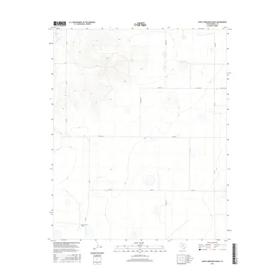
2016 Map of Happy Hereford Ranch
USGS Topo · Published 2016About this map
Happy Hereford Ranch anchors the southern portion of this high plains landscape in Randall County, representing the long-standing ranching traditions of the Texas Panhandle. The terrain is characterized by the sudden elevation changes of the Llano Estacado's canyon systems, most notably around the waters of Buffalo Lake in the northwest corner. This 2016 survey documents a rural environment where large-scale land tracts are defined by a geometric grid of farm-to-market roads and local routes, including FM 168 and FM 1705. The map provides a clear look at the intersection of natural drainage features and human infrastructure, such as Jowell Rd and Haley Rd, which cut across the prairie to serve isolated ranching outposts and agricultural operations.
Find a feature on this map
12 named features on this map. Tap any name to fly to it.
Don’t see what you’re looking for? This feature index may not catch every label — zoom into the map to look around manually.
Map Details
Editions of this 2016 Happy Hereford Ranch Map
This is the sole edition of this map. No revisions or reprints were ever made.
Other maps of this area

1954 · Plainview
USGS Topo · 1:250,000

1954 · Clovis
USGS Topo · 1:250,000

1958 · Clovis
USGS Topo · 1:250,000

1958 · Plainview
USGS Topo · 1:250,000

1960 · Canyon
USGS Topo · 1:62,500

1961 · Buffalo Lake
USGS Topo · 1:62,500

1966 · Tulia NW
USGS Topo · 1:24,000

1966 · Nazareth NW
USGS Topo · 1:24,000

1966 · Arney
USGS Topo · 1:24,000
1984 · Canyon
USGS Topo · 1:24,000