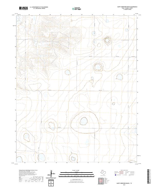
2022 Map of Happy Hereford Ranch
USGS Topo · Published 2022About this map
High plains ranchland defines this section of the Texas Panhandle in Randall County. The landscape is characterized by a network of rural farm-to-market roads and local routes that provide access to the expansive Hereford Ranch area. Significant arteries such as Fm 168 and Fm 1705 anchor the transportation grid, while the presence of S Blessen Rd, Bushland Rd, and Arnot Rd reflects the enduring agricultural and residential divisions of the region. The map reveals the subtle topography of the Llano Estacado, where occasional depressions and seasonal water features dot the terrain between major thoroughfares like Jowell Rd and Haley Rd. This 2022 survey captures the contemporary infrastructure of a traditional ranching landscape, offering a precise look at how property lines and access roads have evolved in this part of West Texas.
Find a feature on this map
10 named features on this map. Tap any name to fly to it.
Don’t see what you’re looking for? This feature index may not catch every label — zoom into the map to look around manually.
Map Details
Editions of this 2022 Happy Hereford Ranch Map
This is the sole edition of this map. No revisions or reprints were ever made.
Other maps of this area

1954 · Plainview
USGS Topo · 1:250,000

1954 · Clovis
USGS Topo · 1:250,000

1958 · Clovis
USGS Topo · 1:250,000

1958 · Plainview
USGS Topo · 1:250,000

1960 · Canyon
USGS Topo · 1:62,500

1961 · Buffalo Lake
USGS Topo · 1:62,500

1966 · Tulia NW
USGS Topo · 1:24,000

1966 · Nazareth NW
USGS Topo · 1:24,000

1966 · Arney
USGS Topo · 1:24,000
1984 · Canyon
USGS Topo · 1:24,000