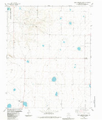
1984 Map of Happy Hereford Ranch
USGS Topo · Published 1984About this map
Buffalo Lake National Wildlife Refuge anchors the northwest corner of this Randall County landscape, where the waters of Buffalo Lake are surrounded by a network of ephemeral basins and depressional wetlands. The area's ranching identity is clearly established at the Happy Hereford Ranch, which features dedicated Landing Strips for local aviation. The settlement patterns of the mid-1980s are captured through small community markers such as Money and the Jowell School, located near a prominent Radio Tower. This survey illustrates a quiet, specialized agricultural environment characterized by isolated water sources, including numerous wells and several active Gravel Pits, reflecting the local dependence on groundwater and extracted resources in the High Plains.
Find a feature on this map
10 named features on this map. Tap any name to fly to it.
Don’t see what you’re looking for? This feature index may not catch every label — zoom into the map to look around manually.
Map Details
Editions of this 1984 Happy Hereford Ranch Map
This is the sole edition of this map. No revisions or reprints were ever made.
Other maps of this area

1954 · Plainview
USGS Topo · 1:250,000

1954 · Clovis
USGS Topo · 1:250,000

1958 · Clovis
USGS Topo · 1:250,000

1958 · Plainview
USGS Topo · 1:250,000

1960 · Canyon
USGS Topo · 1:62,500

1961 · Buffalo Lake
USGS Topo · 1:62,500

1966 · Tulia NW
USGS Topo · 1:24,000

1966 · Nazareth NW
USGS Topo · 1:24,000

1966 · Arney
USGS Topo · 1:24,000
1984 · Canyon
USGS Topo · 1:24,000