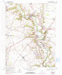
1966 Map of Harrisburg
USGS Topo · Published 1990About this map
Big Darby Creek meanders through the heart of this central Ohio landscape, defining the boundaries between Pleasant and Darby townships. The map documents the mid-century footprint of established villages like Harrisburg and Orient, the latter of which is anchored by the sprawling campus of the Orient State Institute. This area, situated within the Virginia Military District, shows a transition from rural agriculture to early suburban expansion, particularly visible near Pleasant Corners.
Find a feature on this map
57 named features on this map. Tap any name to fly to it.
Don’t see what you’re looking for? This feature index may not catch every label — zoom into the map to look around manually.
Map Details
Editions of this 1966 Harrisburg Map
3 editions found
Other maps of this area

1906 · Mt Sterling
USGS Topo · 1:62,500

1907 · London
USGS Topo · 1:62,500

1911 · Era
USGS Topo · 1:62,500

1913 · Era
USGS Topo · 1:62,500

1923 · West Columbus
USGS Topo · 1:62,500

1925 · West Columbus
USGS Topo · 1:62,500

1943 · Era
USGS Topo · 1:62,500

1947 · Columbus
USGS Topo · 1:250,000

1955 · Harrisburg
USGS Topo · 1:24,000
1955 · Commercial Point
USGS Topo · 1:24,000