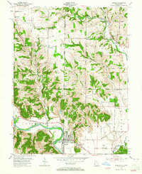
1955 Map of Harrison
USGS Topo · Published 1965About this map
The Whitewater River and its major tributary, the Dry Fork Whitewater River, dominate this mid-century landscape straddling the Ohio-Indiana border. The settlement of Harrison and its neighbor West Harrison serve as the primary hubs, where the New York Central River rail line parallels the water's path. The map captures a well-established rural infrastructure of family and community landmarks, including the Township Sch, St Joseph church, and several burial grounds such as Fairview Cem and Braysville Cem.
Find a feature on this map
66 named features on this map. Tap any name to fly to it.
Don’t see what you’re looking for? This feature index may not catch every label — zoom into the map to look around manually.
Map Details
Editions of this 1955 Harrison Map
5 editions found

Other maps of this area

1914 · West Cincinnati
USGS Topo · 1:62,500

1915 · Lawrenceburg
USGS Topo · 1:48,000

1915 · Harrison
USGS Topo · 1:48,000

1915 · Hamilton
USGS Topo · 1:62,500

1917 · Hamilton
USGS Topo · 1:62,500

1928 · Lawrenceburg
USGS Topo · 1:62,500

1932 · Lawrenceburg
USGS Topo · 1:62,500

1943 · Hooven
USGS Topo · 1:24,000

1943 · Guilford
USGS Topo · 1:24,000

1953 · Guilford
USGS Topo · 1:24,000