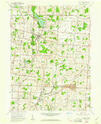
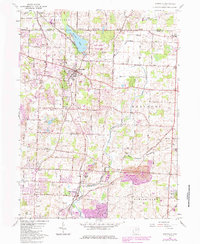
1960 Map of Hartville
USGS Topo · Published 1961About this map
Hartville sits at the center of this northeastern Ohio landscape, where the agricultural traditions of Stark Co and Portage Co meet. The terrain is defined by glacial features, most notably the large Congress Lake and its associated Outlet, alongside the winding Middle Branch Nimishillen Creek. This era of the early 1960s shows a community rich in local history, evidenced by a dense network of country churches and family burial grounds such as St Jacobs Ch, East Nimishillen Ch, and the Machamer Cem.
Find a feature on this map
72 named features on this map. Tap any name to fly to it.
Don’t see what you’re looking for? This feature index may not catch every label — zoom into the map to look around manually.
Map Details
Editions of this 1960 Hartville Map
6 editions found
Other maps of this area

1901 · Canton
USGS Topo · 1:62,500

1903 · Canton
USGS Topo · 1:62,500

1906 · Kent
USGS Topo · 1:62,500

1906 · Ravenna
USGS Topo · 1:62,500

1908 · Ravenna
USGS Topo · 1:62,500

1909 · Alliance
USGS Topo · 1:62,500

1950 · Cleveland
USGS Topo · 1:250,000

1951 · Canton
USGS Topo · 1:250,000

1953 · Canton
USGS Topo · 1:250,000

1956 · Cleveland
USGS Topo · 1:250,000