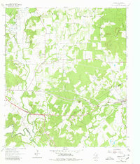
1964 Map of Harwood
USGS Topo · Published 1980About this map
The Southern Pacific line cuts through the heart of the central Texas landscape, anchoring the settlement of Harwood and the small siding at McNeil. In the mid-1960s, this area at the boundary of Caldwell and Gonzales Counties was defined by a mix of agricultural pasture and the persistent extraction of the Salt Flat Oil Field in the northwest. An Old Railroad Grade remains visible, tracing a former path through the terrain south of Plum Creek.
Find a feature on this map
25 named features on this map. Tap any name to fly to it.
Don’t see what you’re looking for? This feature index may not catch every label — zoom into the map to look around manually.
Map Details
Editions of this 1964 Harwood Map
3 editions found
Other maps of this area

1901 · Flatonia
USGS Topo · 1:125,000

1911 · San Marcos
USGS Topo · 1:125,000

1919 · San Marcos
USGS Topo · 1:125,000

1925 · San Marcos 4-c
USGS Topo · 1:48,000

1925 · San Marcos 1-d
USGS Topo · 1:48,000

1925 · San Marcos 4-a
USGS Topo · 1:48,000

1929 · Luling
USGS Topo · 1:62,500

1930 · Lockhart
USGS Topo · 1:62,500

1953 · Seguin
USGS Topo · 1:250,000

1958 · Seguin
USGS Topo · 1:250,000