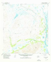
1951 Map of Healy A-2
USGS Topo · Published 1976About this map
Susitna River and its intricate drainage network define this interior Alaskan landscape as it was documented in the early 1950s. The geography is characterized by high alpine basins and significant water bodies like Butte Lake and the smaller Snodgrass Lake. Transportation in this era was anchored by the Denali Highway, which cuts across the northern terrain, providing access to this high-country region of the Matanuska-Susitna Borough.
Find a feature on this map
15 named features on this map. Tap any name to fly to it.
Don’t see what you’re looking for? This feature index may not catch every label — zoom into the map to look around manually.
Map Details
Editions of this 1951 Healy A-2 Map
3 editions found

Other maps of this area

1949 · Healy B-2
USGS Topo · 1:63,360

1949 · Healy A-1
USGS Topo · 1:63,360

1950 · Talkeetna Mountains
USGS Topo · 1:250,000

1950 · Healy A-3
USGS Topo · 1:63,360

1950 · Healy B-3
USGS Topo · 1:63,360

1950 · Healy B-1
USGS Topo · 1:63,360

1951 · Healy
USGS Topo · 1:250,000

1951 · Talkeetna Mountains D-2
USGS Topo · 1:63,360

1951 · Talkeetna Mountains D-1
USGS Topo · 1:63,360

1951 · Talkeetna Mountains D-3
USGS Topo · 1:63,360