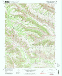
1964 Map of Henderson Ridge
USGS Topo · Published 1982About this map
Henderson Ridge and Brush Mountain dominate this landscape, characterized by a complex network of high mesas and deep drainage basins in Colorado. The 1964 topography reveals a landscape organized around vital water sources, with numerous named springs such as Franklin Spring, Kaiser Spring, and Henderson Spring providing essential resources for the area. The Altenbern Ranch stands as a primary point of human settlement, connected to the broader region by historical routes including the Pack Trail and the Ute Trail (Pack).
Find a feature on this map
57 named features on this map. Tap any name to fly to it.
Don’t see what you’re looking for? This feature index may not catch every label — zoom into the map to look around manually.
Map Details
Editions of this 1964 Henderson Ridge Map
3 editions found
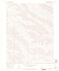
Other maps of this area

1929 · Highmore
USGS Topo · 1:62,500

1929 · Roan Creek
USGS Topo · 1:62,500

1956 · Grand Junction
USGS Topo · 1:250,000

1959 · Grand Junction
USGS Topo · 1:250,000

1960 · Grand Junction
USGS Topo · 1:250,000

1962 · Grand Junction
USGS Topo · 1:250,000

1964 · Grand Junction
USGS Topo · 1:250,000

1964 · Brushy Point
USGS Topo · 1:24,000

1964 · Henderson Ridge
USGS Topo · 1:24,000

1964 · Calf Canyon
USGS Topo · 1:24,000