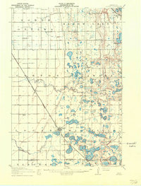
1911 Map of Herman
USGS Topo · Published 1911About this map
The Great Northern railroad corridors define the settlement patterns of this West Central Minnesota landscape, intersecting at the village of Herman. This rail junction is the central hub for a vast agricultural prairie dotted with numerous numbered rural schoolhouses, including School No 62 and School No 46, which suggest a distributed and active farming population in the early 1900s. To the east, the terrain transforms into a dense network of glacial wetlands and water bodies, most notably the Niemackl Lakes, Ohlsrud Lake, and Big Lake. The transition from the flat plains of Logan and North Tintah to the lake-heavy topography of Delaware and Macsville reveals the distinct geological divide that shaped local land use, where the Mustinka River winds through the northwestern townships near Norcross.
Find a feature on this map
47 named features on this map. Tap any name to fly to it.
Don’t see what you’re looking for? This feature index may not catch every label — zoom into the map to look around manually.
Map Details
Editions of this 1911 Herman Map
3 editions found
Other maps of this area

1910 · Wendell
USGS Topo · 1:62,500

1910 · Chokio
USGS Topo · 1:62,500

1911 · Barrett
USGS Topo · 1:62,500

1911 · Herman
USGS Topo · 1:62,500

1912 · Chokio
USGS Topo · 1:62,500

1912 · Morris
USGS Topo · 1:62,500

1913 · Ashby
USGS Topo · 1:62,500

1913 · Wendell
USGS Topo · 1:62,500

1950 · Graceville
USGS Topo · 1:62,500

1951 · Wheaton
USGS Topo · 1:62,500