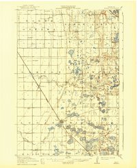
1911 Map of Herman
USGS Topo · Published 1939About this map
Herman serves as the focal point of this 1911 survey, situated at the junction of the Great Northern RR and the Willmar and Larimore Line. The landscape of Grant County is defined by an extensive network of prairie wetlands and glacial lakes, including Big Lake, Olsrud Lake, and Niemakl Lake. The Mustinka River meanders across the townships of North Ottawa and Logan, illustrating the complex hydrology of the region before modern drainage projects reshaped the prairie.
Find a feature on this map
46 named features on this map. Tap any name to fly to it.
Don’t see what you’re looking for? This feature index may not catch every label — zoom into the map to look around manually.
Map Details
Editions of this 1911 Herman Map
3 editions found
Other maps of this area

1910 · Wendell
USGS Topo · 1:62,500

1910 · Chokio
USGS Topo · 1:62,500

1911 · Barrett
USGS Topo · 1:62,500

1911 · Herman
USGS Topo · 1:62,500

1912 · Chokio
USGS Topo · 1:62,500

1912 · Morris
USGS Topo · 1:62,500

1913 · Ashby
USGS Topo · 1:62,500

1913 · Wendell
USGS Topo · 1:62,500

1950 · Graceville
USGS Topo · 1:62,500

1951 · Wheaton
USGS Topo · 1:62,500