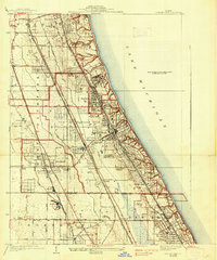
1928 Map of Highland Park
USGS Topo · Published 1938About this map
Fort Sheridan stands prominently along the coastline of Lake Michigan in this 1928 survey, marking a significant military and cultural presence just north of the City of Highland Park. The landscape is defined by its transition from wooded shoreline bluffs to the inland drainage of the Skokie River and the forks of the Chicago River. This era captures the North Shore's peak as a premier recreational and institutional corridor, evidenced by a dense concentration of sporting grounds like the Onwentsia Club, Exmoor Country Club, and Skokie Country Club. Educational landmarks such as Lake Forest Academy and the Sacred Heart Seminary are established amidst growing suburbs like Deerfield and Glencoe. The sophisticated transportation network of the Chicago and Northwestern and the Chicago North Shore and Milwaukee railroads illustrates the area's development into a refined residential and social hub for the Chicago region.
Find a feature on this map
56 named features on this map. Tap any name to fly to it.
Don’t see what you’re looking for? This feature index may not catch every label — zoom into the map to look around manually.
Map Details
Editions of this 1928 Highland Park Map
4 editions found
Other maps of this area

1899 · Evanston
USGS Topo · 1:62,500

1900 · Highwood
USGS Topo · 1:62,500

1906 · Waukegan
USGS Topo · 1:62,500

1908 · Waukegan
USGS Topo · 1:62,500

1927 · Arlington Heights
USGS Topo · 1:24,000

1928 · Wheeling
USGS Topo · 1:24,000

1928 · Highland Park
USGS Topo · 1:24,000

1928 · Evanston
USGS Topo · 1:24,000

1929 · Park Ridge
USGS Topo · 1:24,000

1951 · Highland Park
USGS Topo · 1:24,000