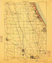
1900 Map of Highwood
USGS Topo · Published 1910About this map
Fort Sheridan and the rugged shoreline of Lake Michigan anchor the northeastern edge of this northern Illinois landscape, surveyed just before the turn of the century. The map illustrates a region in the midst of a suburban transformation, where early rail-oriented settlements like Highland Park, Ravinia, and Glencoe follow the lakefront bluff. Inland, the Desplaines River meanders southward through Wheeling and Maine, serving as a natural corridor alongside the developing prairie towns of Arlington Heights and Desplaines.
Find a feature on this map
52 named features on this map. Tap any name to fly to it.
Don’t see what you’re looking for? This feature index may not catch every label — zoom into the map to look around manually.
Map Details
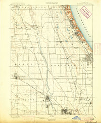
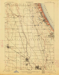
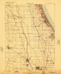
Editions of this 1900 Highwood Map
5 editions found
Other maps of this area

1889 · Chicago
USGS Topo · 1:62,500

1891 · Chicago
USGS Topo · 1:62,500

1891 · Riverside
USGS Topo · 1:62,500

1893 · Riverside
USGS Topo · 1:62,500

1899 · Evanston
USGS Topo · 1:62,500

1900 · Chicago
USGS Topo · 1:62,500

1900 · Riverside
USGS Topo · 1:62,500

1900 · Highwood
USGS Topo · 1:62,500

1901 · Riverside
USGS Topo · 1:62,500

1901 · Chicago
USGS Topo · 1:62,500