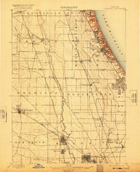
1900 Map of Highwood
USGS Topo · Published 1920About this map
Lake Michigan defines the eastern boundary of this early 20th-century landscape, where a series of residential and military settlements cling to the bluffs. The presence of Fort Sheridan and growing suburban nodes like Highland Park and Highwood highlight the corridor established by the Chicago and Northwestern R. R. near the shoreline. Inland, the terrain shifts toward the fertile lowlands of the Des Plaines River, which meanders south through Wheeling and past The Grove.
Find a feature on this map
52 named features on this map. Tap any name to fly to it.
Don’t see what you’re looking for? This feature index may not catch every label — zoom into the map to look around manually.
Map Details
Editions of this 1900 Highwood Map
5 editions found
Other maps of this area

1889 · Chicago
USGS Topo · 1:62,500

1891 · Chicago
USGS Topo · 1:62,500

1891 · Riverside
USGS Topo · 1:62,500

1893 · Riverside
USGS Topo · 1:62,500

1899 · Evanston
USGS Topo · 1:62,500

1900 · Chicago
USGS Topo · 1:62,500

1900 · Riverside
USGS Topo · 1:62,500

1900 · Highwood
USGS Topo · 1:62,500

1901 · Riverside
USGS Topo · 1:62,500

1901 · Chicago
USGS Topo · 1:62,500