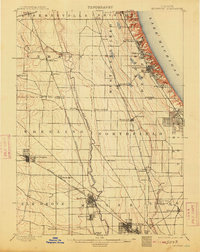
1900 Map of Highwood
USGS Topo · Published 1913About this map
Fort Sheridan stands prominently along the bluffs of Lake Michigan, anchoring a coastal corridor of development at the turn of the century. This landscape is defined by the sharp contrast between the established lakefront communities like Highland Park and Highwood, and the sprawling inland prairies of the Des Plaines River valley. The map reveals the intricate rail infrastructure that facilitated the growth of Cook and Lake Counties, featuring the Chicago and Northwestern R.R. and the Wisconsin Central R.R. intersecting at rural junctions.
Find a feature on this map
52 named features on this map. Tap any name to fly to it.
Don’t see what you’re looking for? This feature index may not catch every label — zoom into the map to look around manually.
Map Details
Editions of this 1900 Highwood Map
5 editions found
Other maps of this area

1889 · Chicago
USGS Topo · 1:62,500

1891 · Chicago
USGS Topo · 1:62,500

1891 · Riverside
USGS Topo · 1:62,500

1893 · Riverside
USGS Topo · 1:62,500

1899 · Evanston
USGS Topo · 1:62,500

1900 · Chicago
USGS Topo · 1:62,500

1900 · Riverside
USGS Topo · 1:62,500

1900 · Highwood
USGS Topo · 1:62,500

1901 · Riverside
USGS Topo · 1:62,500

1901 · Chicago
USGS Topo · 1:62,500