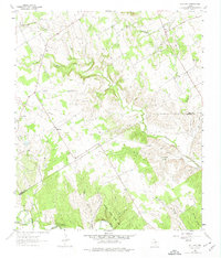
1961 Map of Hill City
USGS Topo · Published 1974About this map
Hill City and Neri anchor this rural landscape in the early 1960s, located at the intersection of Hood and Somervell Counties. The area is defined by a network of drainage systems, including Squaw Creek and the Paluxy River, which cut through the terrain to create distinctive geographic features like Dinosaur Valley. Cultural landmarks of the period include the Neri Sch and Prairie Creek Ch, alongside small family or community burial grounds such as Mt Pleasant Cem and Post Oak Cem.
Find a feature on this map
28 named features on this map. Tap any name to fly to it.
Don’t see what you’re looking for? This feature index may not catch every label — zoom into the map to look around manually.
Map Details
Editions of this 1961 Hill City Map
Other maps of this area

1889 · Granbury
USGS Topo · 1:125,000

1923 · Granbury 2-a
USGS Topo · 1:48,000

1923 · Granbury 1-b
USGS Topo · 1:48,000

1924 · Granbury 1-c
USGS Topo · 1:48,000

1928 · Godley
USGS Topo · 1:62,500

1931 · Morgan
USGS Topo · 1:62,500

1931 · Tolar
USGS Topo · 1:62,500

1954 · Dallas
USGS Topo · 1:250,000

1958 · Dallas
USGS Topo · 1:250,000
1960 · Tolar
USGS Topo · 1:24,000