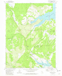
1981 Map of Hobart Mills
USGS Topo · Published 1982About this map
Hobart Mills and the industrial remnants of the Old Smith Mill (Site) anchor this portion of the Tahoe National Forest in the early 1980s. The landscape is defined by significant water management and research infrastructure, featuring the sprawling Stampede Reservoir to the north and Prosser Creek Reservoir to the south. Between these bodies of water, the University of California Wildlife Experiment Station sits along Sagehen Creek, highlighting the area's transition from a timber-milling hub to a center for ecological study and recreation. Local history is etched into the terrain through features like the Winnie Smith Mill (Site) and numerous springs, including Woodchoppers Spring. The map documents a rugged network of four-wheel-drive trails and forest roads that connect high points like Billy Hill and the Sagehen Hills, providing a detailed record of the Sierra Nevada's multi-use forest management era.
Find a feature on this map
48 named features on this map. Tap any name to fly to it.
Don’t see what you’re looking for? This feature index may not catch every label — zoom into the map to look around manually.
Map Details
Editions of this 1981 Hobart Mills Map
3 editions found
Other maps of this area

1890 · Sierraville
USGS Topo · 1:125,000

1891 · Truckee
USGS Topo · 1:125,000

1892 · Sierraville
USGS Topo · 1:125,000

1893 · Truckee
USGS Topo · 1:125,000

1894 · Sierraville
USGS Topo · 1:125,000

1895 · Truckee
USGS Topo · 1:125,000

1932 · Truckee
USGS Topo · 1:96,000

1940 · Truckee
USGS Topo · 1:125,000

1955 · Truckee
USGS Topo · 1:24,000

1955 · Loyalton
USGS Topo · 1:62,500