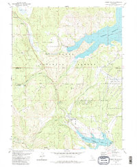
1981 Map of Hobart Mills
USGS Topo · Published 1986About this map
Hobart Mills stands as the central settlement in this high-elevation landscape within the Tahoe National Forest. The geography is defined by the management of water and timber, evidenced by the expansive reaches of the Stampede Reservoir and Prosser Creek Reservoir. For historians, the map preserves the locations of early industrial activity at the Old Smith Mill (Site) and the Winnie Smith Mill (Site), marking the region's transition from active lumber production to a focus on conservation and recreation.
Find a feature on this map
35 named features on this map. Tap any name to fly to it.
Don’t see what you’re looking for? This feature index may not catch every label — zoom into the map to look around manually.
Map Details
Editions of this 1981 Hobart Mills Map
3 editions found
Other maps of this area

1890 · Sierraville
USGS Topo · 1:125,000

1891 · Truckee
USGS Topo · 1:125,000

1892 · Sierraville
USGS Topo · 1:125,000

1893 · Truckee
USGS Topo · 1:125,000

1894 · Sierraville
USGS Topo · 1:125,000

1895 · Truckee
USGS Topo · 1:125,000

1932 · Truckee
USGS Topo · 1:96,000

1940 · Truckee
USGS Topo · 1:125,000

1955 · Truckee
USGS Topo · 1:24,000

1955 · Loyalton
USGS Topo · 1:62,500