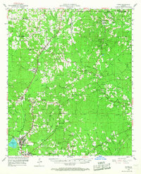
1953 Map of Hodge
USGS Topo · Published 1967About this map
Hodge and the neighboring seat of Jonesboro anchor the southern portion of this mid-century survey, a landscape defined by the drainage of the Dugdemona River and its numerous bayous. In the 1950s, the region was a network of rural communities connected by the Rock Island and Chicago Pacific Railroad and an extensive system of forest-spanning pipelines. A transition in land use is visible near Ansley, where an old railroad grade marks a path through the timber towards Quitman. The sheet is notably dense with community focal points, from the Saints Rest Sch and Ebenezer Sch to the abandoned China Grove Sch. For genealogists, the map provides precise locations for family landmarks like Stringer Cem and Wesley Chapel Cem, alongside smaller settlements like Punkin Center and Woodville.
Find a feature on this map
82 named features on this map. Tap any name to fly to it.
Don’t see what you’re looking for? This feature index may not catch every label — zoom into the map to look around manually.
Map Details
Editions of this 1953 Hodge Map
5 editions found

Other maps of this area

1947 · Goldonna
USGS Topo · 1:62,500

1947 · Bienville
USGS Topo · 1:62,500

1949 · Bienville
USGS Topo · 1:62,500

1949 · Jonesboro
USGS Topo · 1:62,500

1950 · Jonesboro
USGS Topo · 1:62,500

1950 · Ruston
USGS Topo · 1:62,500

1950 · Arcadia
USGS Topo · 1:62,500

1951 · Arcadia
USGS Topo · 1:62,500

1951 · Ruston
USGS Topo · 1:62,500

1952 · Calhoun
USGS Topo · 1:62,500