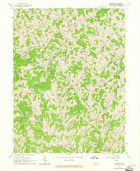
1964 Map of Holbrook
USGS Topo · Published 1965About this map
State Game Lands No 179 dominates the dissected plateau of southwestern Pennsylvania, where the landscape is marked by a high density of gas wells and winding ridge roads. In the mid-1960s, small crossroads communities like White Cottage, Holbrook, and Pine Bank served as local hubs for the surrounding farmsteads. The educational center of the area is anchored by West Greene High Sch near the northern boundary, while spiritual life is reflected in several country churches, including Valley Chapel Ch and Mt Zion Ch.
Find a feature on this map
43 named features on this map. Tap any name to fly to it.
Don’t see what you’re looking for? This feature index may not catch every label — zoom into the map to look around manually.
Map Details
Editions of this 1964 Holbrook Map
2 editions found
Other maps of this area

1901 · Waynesburg
USGS Topo · 1:62,500

1904 · Blacksville
USGS Topo · 1:62,500

1904 · Waynesburg
USGS Topo · 1:62,500

1905 · Mannington
USGS Topo · 1:62,500

1905 · Rogersville
USGS Topo · 1:62,500

1923 · Blacksville
USGS Topo · 1:62,500

1923 · Mannington
USGS Topo · 1:62,500

1925 · Blacksville
USGS Topo · 1:62,500

1926 · Mannington
USGS Topo · 1:62,500

1949 · Clarksburg
USGS Topo · 1:250,000