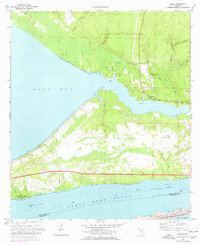
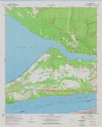
1970 Map of Holley
USGS Topo · Published 1977About this map
The settlement of Holley and the surrounding coastal lowlands define this survey, conducted as the Florida Panhandle balanced military expansion with the growth of waterfront communities. The map tracks the complex shoreline where East Bay meets Santa Rosa Sound, a landscape heavily influenced by the presence of Eglin Air Force Base and Holley Field (Air Force OLF). These installations occupy significant acreage, bordering a intricate network of waterways like Tom King Bayou and Alabama Bayou. To the south, Woodlawn Beach serves as a residential anchor along the Sound, while a small Cem near Harper provides a point of interest for genealogists. The topography is largely defined by water, from the Intracoastal Waterway to the shifting Sand Dunes of Santa Rosa Island, illustrating the region's reliance on marine transit and strategic coastal positioning during the mid-to-late 20th century.
Find a feature on this map
38 named features on this map. Tap any name to fly to it.
Don’t see what you’re looking for? This feature index may not catch every label — zoom into the map to look around manually.
Map Details
Editions of this 1970 Holley Map
5 editions found
Other maps of this area

1920 · Milton
USGS Topo · 1:62,500

1921 · Holley
USGS Topo · 1:62,500

1921 · Pensacola
USGS Topo · 1:62,500

1934 · Harold
USGS Topo · 1:62,500

1936 · Holley
USGS Topo · 1:48,000

1937 · Harold
USGS Topo · 1:62,500

1938 · Holley
USGS Topo · 1:62,500

1938 · Harold
USGS Topo · 1:62,500

1941 · Pensacola
USGS Topo · 1:62,500

1941 · Milton
USGS Topo · 1:62,500