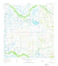
1952 Map of Holy Cross A-6
USGS Topo · Published 1976About this map
Meandering through the northern interior of the Nageethluk River and its intricate network of oxbow lakes, this 1950s survey documents a landscape defined by water and wetlands. The Kukutluk River cuts through the southwestern corner, showing the distinct contrast between the level, lake-dotted lowlands and the rising hills of the Yukon-Kuskokwim region. This topographic study was mapped by the Army Map Service using photogrammetric methods from aerial photographs taken in 1951 and 1952, capturing the region's natural drainage patterns before any roads or trails were established in this section of the territory.
Find a feature on this map
2 named features on this map. Tap any name to fly to it.
Don’t see what you’re looking for? This feature index may not catch every label — zoom into the map to look around manually.
Map Details
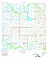
Editions of this 1952 Holy Cross A-6 Map
3 editions found

Other maps of this area

1947 · Russian Mission
USGS Topo · 1:250,000

1950 · Russian Mission
USGS Topo · 1:250,000

1951 · Marshall
USGS Topo · 1:250,000

1951 · Holy Cross
USGS Topo · 1:250,000

1951 · Holy Cross A-5
USGS Topo · 1:63,360

1952 · Kwiguk
USGS Topo · 1:250,000

1952 · Holy Cross B-6
USGS Topo · 1:63,360

1952 · Holy Cross B-5
USGS Topo · 1:63,360

1952 · Kwiguk A-1
USGS Topo · 1:63,360

1952 · Kwiguk B-1
USGS Topo · 1:63,360