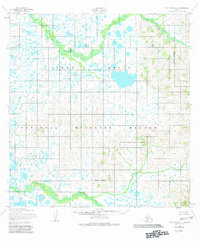
1952 Map of Holy Cross A-6
USGS Topo · Published 1982About this map
The Yukon Delta landscape is defined by a dense network of marshes and watercourses, mapped here in the early 1950s using aerial photography. The Nageethluk River winds through the northern portion of the quadrangle, while the southern terrain is crossed by the Kuyukutuk River. This region is almost entirely comprised of low-relief wetlands, punctuated by countless unnamed lakes and ponds characteristic of the Alaskan coastal plain. The map reflects a 1982 revision that overlayed the Yukon Delta National Wildlife Refuge and its associated Refuge Boundary following the Alaska National Interest Lands Conservation Act. This survey provides a baseline of the hydrologic patterns before modern climatic shifts, showing the intricate natural drainage and unmarked land lines predetermined by the Bureau of Land Management.
Find a feature on this map
5 named features on this map. Tap any name to fly to it.
Don’t see what you’re looking for? This feature index may not catch every label — zoom into the map to look around manually.
Map Details
Editions of this 1952 Holy Cross A-6 Map
3 editions found

Other maps of this area

1947 · Russian Mission
USGS Topo · 1:250,000

1950 · Russian Mission
USGS Topo · 1:250,000

1951 · Marshall
USGS Topo · 1:250,000

1951 · Holy Cross
USGS Topo · 1:250,000

1951 · Holy Cross A-5
USGS Topo · 1:63,360

1952 · Kwiguk
USGS Topo · 1:250,000

1952 · Holy Cross B-6
USGS Topo · 1:63,360

1952 · Holy Cross B-5
USGS Topo · 1:63,360

1952 · Kwiguk A-1
USGS Topo · 1:63,360

1952 · Kwiguk B-1
USGS Topo · 1:63,360