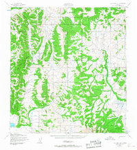
1952 Map of Holy Cross B-1
USGS Topo · Published 1967About this map
Fox Hills anchors the southern portion of this interior Alaskan landscape, mapped during the early 1950s by the Army Map Service. The terrain is defined by a dense network of ridges and drainages, where the only human-constructed route shown is the Winter Trail, winding its way across the central and southeastern slopes. This survey reflects the remote character of the Yukon-Koyukuk region before more modern infrastructure was introduced, capturing a landscape where seasonal travel routes were the primary means of navigating the wilderness. The detailed contour intervals reveal a complex topography of high summits and deep valleys, characteristic of this part of the subarctic interior during the mid-twentieth century.
Find a feature on this map
2 named features on this map. Tap any name to fly to it.
Don’t see what you’re looking for? This feature index may not catch every label — zoom into the map to look around manually.
Map Details
Editions of this 1952 Holy Cross B-1 Map
2 editions found
Other maps of this area

1951 · Holy Cross
USGS Topo · 1:250,000

1951 · Iditarod
USGS Topo · 1:250,000

1952 · Holy Cross B-2
USGS Topo · 1:63,360

1952 · Holy Cross A-2
USGS Topo · 1:63,360

1952 · Holy Cross C-2
USGS Topo · 1:63,360

1952 · Holy Cross C-1
USGS Topo · 1:63,360

1952 · Holy Cross A-1
USGS Topo · 1:63,360

1952 · Holy Cross B-1
USGS Topo · 1:63,360

1952 · Holy Cross
USGS Topo · 1:250,000

1954 · Iditarod A-6
USGS Topo · 1:63,360