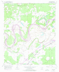
1951 Map of Homan
USGS Topo · Published 1975About this map
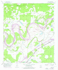
The Red River creates a serpentine border through this delta landscape in southwest Arkansas, defining the geography of the Homan and Johnson districts. The 1951 topography reveals a sophisticated network of water management, where numerous oxbow lakes such as Old River Lake, Bear Lake, and Horseshoe Lake are protected by an extensive Levee system and artificial channels like Gillespie Ditch. This reliance on drainage infrastructure highlights the area's agricultural focus, necessitated by the river's historical tendency to shift course.
Find a feature on this map
32 named features on this map. Tap any name to fly to it.
Don’t see what you’re looking for? This feature index may not catch every label — zoom into the map to look around manually.
Map Details
Editions of this 1951 Homan Map
6 editions found
Other maps of this area

1909 · Texarkana
USGS Topo · 1:62,500

1950 · Ashdown East
USGS Topo · 1:24,000

1950 · Ogden
USGS Topo · 1:24,000

1950 · Red Bluff
USGS Topo · 1:24,000

1951 · Ogden
USGS Topo · 1:24,000

1951 · Red Bluff
USGS Topo · 1:24,000

1951 · Ashdown East
USGS Topo · 1:24,000

1951 · Homan
USGS Topo · 1:24,000

1951 · Fulton
USGS Topo · 1:24,000

1951 · Mc Nab
USGS Topo · 1:24,000