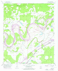
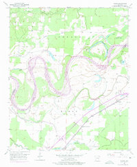
1951 Map of Homan
USGS Topo · Published 1976About this map
The meandering Red River dominates this southwestern Arkansas landscape, its serpentine path forming the boundary between Miller County and Little River County. The river's dynamic history is written in its oxbows and remnant water bodies, including Old River Lake, Horseshoe Lake, and Cutoff Lake. This mid-century survey reveals a highly managed floodplain, where an extensive levee system and the Gillespie Ditch attempt to control the seasonal fluctuations of the river and its tributaries like McKinney Bayou.
Find a feature on this map
31 named features on this map. Tap any name to fly to it.
Don’t see what you’re looking for? This feature index may not catch every label — zoom into the map to look around manually.
Map Details
Editions of this 1951 Homan Map
6 editions found
Other maps of this area

1909 · Texarkana
USGS Topo · 1:62,500

1950 · Ashdown East
USGS Topo · 1:24,000

1950 · Ogden
USGS Topo · 1:24,000

1950 · Red Bluff
USGS Topo · 1:24,000

1951 · Ogden
USGS Topo · 1:24,000

1951 · Red Bluff
USGS Topo · 1:24,000

1951 · Ashdown East
USGS Topo · 1:24,000

1951 · Homan
USGS Topo · 1:24,000

1951 · Fulton
USGS Topo · 1:24,000

1951 · Mc Nab
USGS Topo · 1:24,000